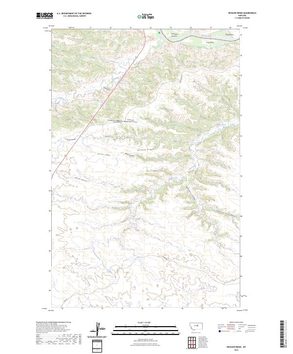
2024 Map of Hessler Ridge
USGS Topo · Published 2024About this map
The Missouri River carves a path through the northern reaches of this territory, where the Charles M Russell National Wildlife Refuge and the Upper Missouri River Breaks National Monument converge. The landscape is defined by a complex network of erosional features, including Roach Gulch, Musselman Coulee, and Downer Coulee, all draining toward the river's path. These coulees and ridges characterize the rugged breaks that have historically limited large-scale development in this part of Fergus County.
Find a feature on this map
25 named features on this map. Tap any name to fly to it.
Don’t see what you’re looking for? This feature index may not catch every label — zoom into the map to look around manually.
Map Details
Editions of this 2024 Hessler Ridge Map
This is the sole edition of this map. No revisions or reprints were ever made.
Other maps of this area

1943 · Landusky
USGS Topo · 1:125,000

1954 · Bell Ridge East
USGS Topo · 1:24,000

1954 · Hessler Ridge
USGS Topo · 1:24,000

1954 · Carter Coulee
USGS Topo · 1:24,000

1954 · Bell Ridge West
USGS Topo · 1:24,000

1954 · Grand Island
USGS Topo · 1:24,000

1954 · Lewistown
USGS Topo · 1:250,000

1959 · Lewistown
USGS Topo · 1:250,000

1984 · Zortman
USGS Topo · 1:100,000

1985 · Griffee Coulee
USGS Topo · 1:24,000