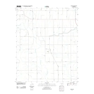
2012 Map of Hester
USGS Topo · Published 2012About this map
Hester serves as the central point of this southwestern Oklahoma landscape, where the agricultural grid meets the winding path of the Salt Fork Red River. The map documents a rural environment structured by an extensive network of range and section line roads, including Frontage Rd and E 1500 Rd, which facilitate the region's farming and ranching activities. Water management is a visible priority for local land use, evidenced by the presence of Borders Lake and the West Canal, while Bitter Cr meanders through the eastern sections. Genealogists and local historians will find value in the location of the Hester Cem, situated northeast of the main settlement near E1520 Rd, providing a specific point of reference for family research in Greer County.
Find a feature on this map
29 named features on this map. Tap any name to fly to it.
Don’t see what you’re looking for? This feature index may not catch every label — zoom into the map to look around manually.
Map Details
Editions of this 2012 Hester Map
This is the sole edition of this map. No revisions or reprints were ever made.
Other maps of this area

1955 · Lawton
USGS Topo · 1:250,000

1964 · Martha
USGS Topo · 1:24,000

1964 · Altus
USGS Topo · 1:24,000

1971 · Blair
USGS Topo · 1:24,000

1971 · Mangum North
USGS Topo · 1:24,000

1971 · Granite
USGS Topo · 1:24,000

1971 · Mangum South
USGS Topo · 1:24,000

1971 · Duke
USGS Topo · 1:24,000

1971 · Hester
USGS Topo · 1:24,000

1971 · Lake Altus
USGS Topo · 1:24,000