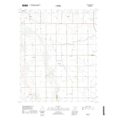
2018 Map of Hester
USGS Topo · Published 2018About this map
The Salt Fork Red River meanders southward through this West Oklahoma landscape, defining the rural character of the borderlands between Greer and Jackson counties. The small settlement of Hester serves as a central point in a grid of section roads, situated just north of the county line. This 2018 survey reveals the persistent agricultural and hydrological patterns of the region, anchored by the W Canal and the course of Bitter Creek. To the northwest, the edge of Mangum is visible, while the Hester Cemetery stands as a local landmark for genealogists and local historians. The presence of Borders Lake and the wide, sandy bed of the river illustrate the semi-arid riverine environment typical of this portion of the Oklahoma prairie.
Find a feature on this map
26 named features on this map. Tap any name to fly to it.
Don’t see what you’re looking for? This feature index may not catch every label — zoom into the map to look around manually.
Map Details
Editions of this 2018 Hester Map
This is the sole edition of this map. No revisions or reprints were ever made.
Other maps of this area

1955 · Lawton
USGS Topo · 1:250,000

1964 · Martha
USGS Topo · 1:24,000

1964 · Altus
USGS Topo · 1:24,000

1971 · Blair
USGS Topo · 1:24,000

1971 · Mangum North
USGS Topo · 1:24,000

1971 · Granite
USGS Topo · 1:24,000

1971 · Mangum South
USGS Topo · 1:24,000

1971 · Duke
USGS Topo · 1:24,000

1971 · Hester
USGS Topo · 1:24,000

1971 · Lake Altus
USGS Topo · 1:24,000