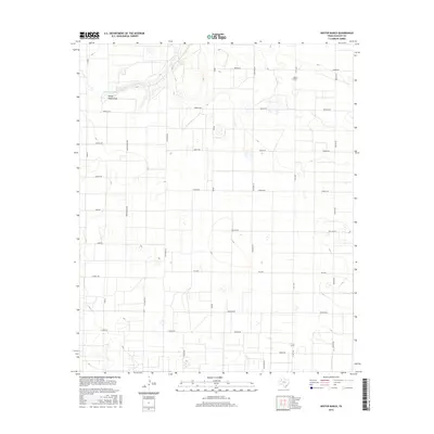
2016 Map of Hester Ranch
USGS Topo · Published 2016About this map
Hester Ranch stands as a focal point in this portion of the Texas Panhandle, situated within a vast grid of rural roads named for international cities and countries. The landscape is defined by the ephemeral waters of Yellow House Draw, which carves a path through the plains near Gordon Cobb Lake. This 2016 survey illustrates the organized agricultural layout typical of Hockley County, where roads such as India Rd, Greece, and Canada Rd create a geometric framework for local land use. This road naming convention provides a distinctive spatial identity to the area, assisting researchers in localizing property boundaries and historical land tracts. The presence of Fm 2306 and N Fm 1490 anchors the transportation network, connecting these remote ranching lands to the broader region of West Texas.
Find a feature on this map
26 named features on this map. Tap any name to fly to it.
Don’t see what you’re looking for? This feature index may not catch every label — zoom into the map to look around manually.
Map Details
Editions of this 2016 Hester Ranch Map
This is the sole edition of this map. No revisions or reprints were ever made.
Other maps of this area

1954 · Brownfield
USGS Topo · 1:250,000

1958 · Brownfield
USGS Topo · 1:250,000

1962 · Brownfield
USGS Topo · 1:250,000

1964 · Oklahoma Flat
USGS Topo · 1:24,000

1964 · Pep
USGS Topo · 1:24,000

1964 · Lums Chapel
USGS Topo · 1:24,000

1964 · Whitharral
USGS Topo · 1:24,000

1965 · Levelland West
USGS Topo · 1:24,000

1965 · Levelland East
USGS Topo · 1:24,000

1965 · Hester Ranch
USGS Topo · 1:24,000