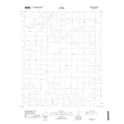
2019 Map of Hester Ranch
USGS Topo · Published 2019About this map
Yellow House Draw meanders across the northwestern portion of this landscape, carving a subtle drainage through the High Plains. This area of Hockley County is defined by a rigid grid of rural roads and the eponymous Hester Ranch, reflecting the enduring ranching and agricultural heritage of the Texas Panhandle. The map reveals an interesting nomenclature for the local thoroughfares, where international names like Canada Rd, Denmark Rd, and Mexico Rd intersect with regional connectors such as Fm 2306. The wide-open terrain is marked by numerous small depressions and basins, typical of the Llano Estacado, which provide a contrast to the geometric precision of the property boundaries and road networks like N Fm 1490.
Find a feature on this map
20 named features on this map. Tap any name to fly to it.
Don’t see what you’re looking for? This feature index may not catch every label — zoom into the map to look around manually.
Map Details
Editions of this 2019 Hester Ranch Map
This is the sole edition of this map. No revisions or reprints were ever made.
Other maps of this area

1954 · Brownfield
USGS Topo · 1:250,000

1958 · Brownfield
USGS Topo · 1:250,000

1962 · Brownfield
USGS Topo · 1:250,000

1964 · Oklahoma Flat
USGS Topo · 1:24,000

1964 · Pep
USGS Topo · 1:24,000

1964 · Lums Chapel
USGS Topo · 1:24,000

1964 · Whitharral
USGS Topo · 1:24,000

1965 · Levelland West
USGS Topo · 1:24,000

1965 · Levelland East
USGS Topo · 1:24,000

1965 · Hester Ranch
USGS Topo · 1:24,000