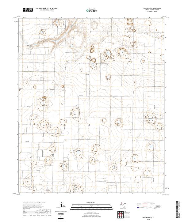
2022 Map of Hester Ranch
USGS Topo · Published 2022About this map
Yellow House Draw meanders across the northern portion of this Hockley County landscape, providing the primary topographical relief in a region otherwise defined by a meticulous grid of rural section roads. The naming convention of the local thoroughfares reflects an eclectic, international theme, with routes like Monaco Rd, Mexico Rd, and Norway Rd partitioning the terrain into large agricultural blocks. This survey reveals a transition from these named country lanes to state-maintained infrastructure such as Fm 2306 and N Fm 1490. Small depressions and localized wetlands dot the interior of these blocks, highlighting the subtle drainage patterns of the Llano Estacado. The presence of labels like Greece, Juneau, and Frankfurt along the road network suggests specific points of local interest or historical intersections within this high-plains farming territory.
Find a feature on this map
23 named features on this map. Tap any name to fly to it.
Don’t see what you’re looking for? This feature index may not catch every label — zoom into the map to look around manually.
Map Details
Editions of this 2022 Hester Ranch Map
This is the sole edition of this map. No revisions or reprints were ever made.
Other maps of this area

1954 · Brownfield
USGS Topo · 1:250,000

1958 · Brownfield
USGS Topo · 1:250,000

1962 · Brownfield
USGS Topo · 1:250,000

1964 · Oklahoma Flat
USGS Topo · 1:24,000

1964 · Pep
USGS Topo · 1:24,000

1964 · Lums Chapel
USGS Topo · 1:24,000

1964 · Whitharral
USGS Topo · 1:24,000

1965 · Levelland West
USGS Topo · 1:24,000

1965 · Levelland East
USGS Topo · 1:24,000

1965 · Hester Ranch
USGS Topo · 1:24,000