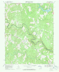
1969 Map of Hewlett
USGS Topo · Published 1971About this map
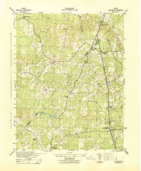
The North Anna River carves a winding path along the boundary between Hanover and Caroline counties, defining the character of this rural Virginia landscape in the late 1960s. The Chesapeake and Ohio railroad serves as the primary corridor for human activity, connecting small rail stops and settlements like Noel, Hewlett, and Holliday. This transit network is punctuated by numerous local landmarks that offer significant value for genealogical research, including several rural congregations such as Mt Salem Ch, Elon Ch, and Mt Carmel Ch.
Find a feature on this map
35 named features on this map. Tap any name to fly to it.
Don’t see what you’re looking for? This feature index may not catch every label — zoom into the map to look around manually.
Map Details
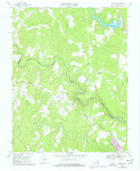
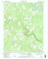
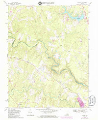
Editions of this 1969 Hewlett Map
4 editions found
Other maps of this area

1887 · Spottsylvania
USGS Topo · 1:125,000

1889 · Fredericksburg
USGS Topo · 1:125,000

1890 · Goochland
USGS Topo · 1:125,000

1892 · Fredericksburg
USGS Topo · 1:125,000

1892 · Spottsylvania
USGS Topo · 1:125,000

1892 · Goochland
USGS Topo · 1:125,000

1894 · Fredericksburg
USGS Topo · 1:125,000

1918 · Doswell
USGS Topo · 1:62,500

1942 · Woodford
USGS Topo · 1:31,680
1942 · Ladysmith
USGS Topo · 1:31,680