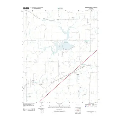
2010 Map of Heyburn Reservoir
USGS Topo · Published 2010About this map
Heyburn Lake and the structural engineering of the Heyburn Dam define the geography of this Creek County landscape. The impoundment of Polecat Creek created a significant water body that dictates local transit and land use, surrounded by a network of rural routes such as Old Hwy 66 and W 141st St S. The settlement of Heyburn and the nearby Worman Junction anchor the eastern side of the reservoir, while the southern reaches are marked by the open expanse of Wildhorse Prairie. Genealogists and local historians can find several burial sites preserved on this sheet, including Sunrise Cemetery, Provens Cemetery, and Fortyfour Cemetery. The area’s aviation history is represented by Neversweat Airport, located near the winding course of Neuersweat Creek.
Find a feature on this map
39 named features on this map. Tap any name to fly to it.
Don’t see what you’re looking for? This feature index may not catch every label — zoom into the map to look around manually.
Map Details
Editions of this 2010 Heyburn Reservoir Map
This is the sole edition of this map. No revisions or reprints were ever made.
Other maps of this area

1901 · Nuyaka
USGS Topo · 1:125,000

1912 · Hominy
USGS Topo · 1:125,000

1914 · Kiefer
USGS Topo · 1:62,500

1915 · Hominy
USGS Topo · 1:125,000

1916 · Kiefer
USGS Topo · 1:62,500

1916 · Bristow
USGS Topo · 1:62,500

1954 · Oklahoma City
USGS Topo · 1:250,000

1955 · Enid
USGS Topo · 1:250,000

1957 · Oklahoma City
USGS Topo · 1:250,000

1958 · Enid
USGS Topo · 1:250,000