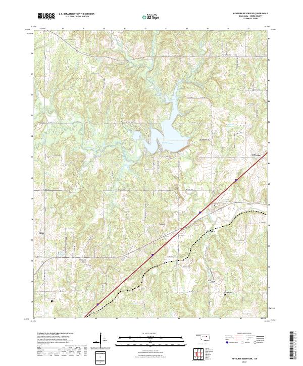
2022 Map of Heyburn Reservoir
USGS Topo · Published 2022About this map
Heyburn Lake and its surrounding watershed dominate this modern landscape in Creek County, Oklahoma. The impoundment of Polecat Creek created a central water feature that reorganized local transport and settlement patterns, with Heyburn Lake Rd providing access to the northern shores. To the east, the settlement of Kellyville sits along the historic corridor of Old Hwy 66, while the small community of Heyburn is situated just south of the reservoir's main body.
Find a feature on this map
83 named features on this map. Tap any name to fly to it.
Don’t see what you’re looking for? This feature index may not catch every label — zoom into the map to look around manually.
Map Details
Editions of this 2022 Heyburn Reservoir Map
This is the sole edition of this map. No revisions or reprints were ever made.
Other maps of this area

1901 · Nuyaka
USGS Topo · 1:125,000

1912 · Hominy
USGS Topo · 1:125,000

1914 · Kiefer
USGS Topo · 1:62,500

1915 · Hominy
USGS Topo · 1:125,000

1916 · Kiefer
USGS Topo · 1:62,500

1916 · Bristow
USGS Topo · 1:62,500

1954 · Oklahoma City
USGS Topo · 1:250,000

1955 · Enid
USGS Topo · 1:250,000

1957 · Oklahoma City
USGS Topo · 1:250,000

1958 · Enid
USGS Topo · 1:250,000