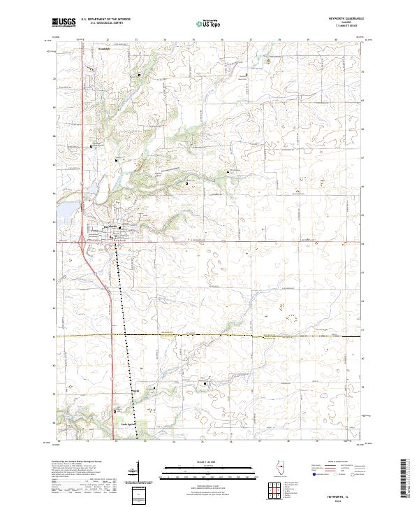
2024 Map of Heyworth
USGS Topo · Published 2024About this map
Heyworth serves as the central hub of this Central Illinois landscape, where the prairie is bisected by the county line between McLean Co and De Witt Co. The region is defined by a dense network of country roads, including Co Rd 1450 E and Old US Hwy 51, which connect small communities like Randolph and Bucks to the surrounding agricultural lands. The terrain is shaped by the winding paths of Kickapoo Creek and Long Point Creek, providing a natural contrast to the rigid grid of section lines.
Find a feature on this map
101 named features on this map. Tap any name to fly to it.
Don’t see what you’re looking for? This feature index may not catch every label — zoom into the map to look around manually.
Map Details
Editions of this 2024 Heyworth Map
This is the sole edition of this map. No revisions or reprints were ever made.
Other maps of this area

1949 · Mc Lean
USGS Topo · 1:62,500

1951 · McLean
USGS Topo · 1:62,500

1951 · Le Roy
USGS Topo · 1:62,500

1957 · Kenney
USGS Topo · 1:62,500

1957 · Maroa
USGS Topo · 1:62,500

1958 · Peoria
USGS Topo · 1:250,000

1961 · Peoria
USGS Topo · 1:250,000

1963 · Peoria
USGS Topo · 1:250,000

1979 · De Witt
USGS Topo · 1:24,000
1979 · Clinton
USGS Topo · 1:24,000