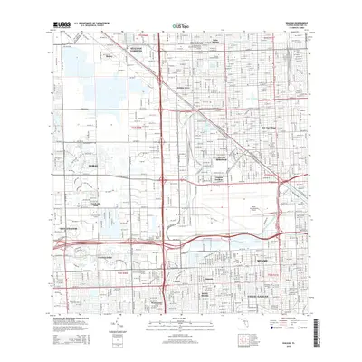
2015 Map of Hialeah
USGS Topo · Published 2015About this map
Miami Springs and the surrounding urban corridors of northwest Miami-Dade County appear here in a complex network of residential developments and industrial zones. The landscape is defined by its drainage infrastructure, including the prominent Miami Canal and Tamiami Canal Number 4, which frame the rapid growth of communities like Hialeah and Hialeah Gardens. Large-scale facilities such as the Miami International Airport and numerous educational campuses like the Everest Institute-Hialeah reflect the region's mid-century expansion into a major metropolitan hub.
Find a feature on this map
100 named features on this map. Tap any name to fly to it.
Don’t see what you’re looking for? This feature index may not catch every label — zoom into the map to look around manually.
Map Details
Editions of this 2015 Hialeah Map
This is the sole edition of this map. No revisions or reprints were ever made.
Other maps of this area

1947 · North Miami
USGS Topo · 1:24,000

1947 · Key Biscayne
USGS Topo · 1:24,000

1949 · Opalocka
USGS Topo · 1:24,000

1949 · South Miami NW
USGS Topo · 1:24,000

1949 · Key Biscayne
USGS Topo · 1:24,000

1950 · Hialeah
USGS Topo · 1:24,000

1950 · Miami
USGS Topo · 1:24,000

1950 · North Miami
USGS Topo · 1:24,000

1950 · South Miami
USGS Topo · 1:24,000

1955 · South Miami NW
USGS Topo · 1:24,000