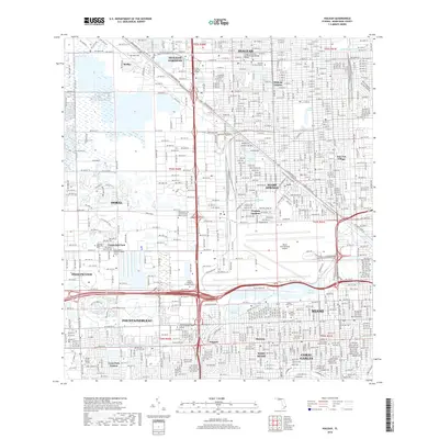
2018 Map of Hialeah
USGS Topo · Published 2018About this map
Miami Springs and Hialeah anchor this urban corridor, where a dense network of canals and aviation infrastructure defines the landscape. The northern portion of Miami International Airport dominates the central-east, situated just south of the residential streets of Virginia Gardens. The map illustrates the complex water management system of the Everglades edge, including the Miami Canal, Tamiami Canal Number C-4, and the Little River Canal.
Find a feature on this map
66 named features on this map. Tap any name to fly to it.
Don’t see what you’re looking for? This feature index may not catch every label — zoom into the map to look around manually.
Map Details
Editions of this 2018 Hialeah Map
This is the sole edition of this map. No revisions or reprints were ever made.
Other maps of this area

1947 · North Miami
USGS Topo · 1:24,000

1947 · Key Biscayne
USGS Topo · 1:24,000

1949 · Opalocka
USGS Topo · 1:24,000

1949 · South Miami NW
USGS Topo · 1:24,000

1949 · Key Biscayne
USGS Topo · 1:24,000

1950 · Hialeah
USGS Topo · 1:24,000

1950 · Miami
USGS Topo · 1:24,000

1950 · North Miami
USGS Topo · 1:24,000

1950 · South Miami
USGS Topo · 1:24,000

1955 · South Miami NW
USGS Topo · 1:24,000