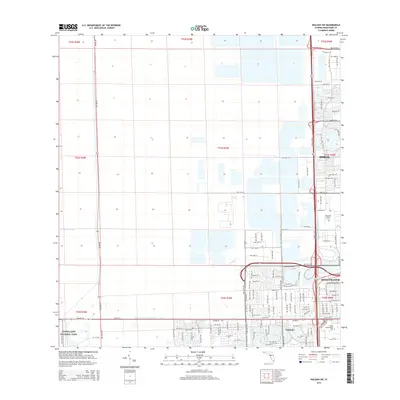
2015 Map of Hialeah SW
USGS Topo · Published 2015About this map
Everglades National Park meets the expanding urban edge of Miami-Dade County in this 2015 survey. The landscape is defined by the rigid geometry of the Public Land Survey System, where sections are carved out by a network of drainage infrastructure like the Agricultural Canal and Tamiami Canal Number C-4. Major arterial routes including Krome Ave and Florida's Tpke frame the rapid development of Doral and Sweetwater. Institutional footprints are prominent in the southeast corner, where the campus of Florida International Univ sits adjacent to the residential blocks of Tamiami. To the north, the sprawling grounds of Our Lady of Mercy Cem provide a transition between the industrial and commercial corridors along NW 58th St and the suburban neighborhoods that have filled the once-marshy terrain east of the Everglades boundary.
Find a feature on this map
47 named features on this map. Tap any name to fly to it.
Don’t see what you’re looking for? This feature index may not catch every label — zoom into the map to look around manually.
Map Details
Editions of this 2015 Hialeah SW Map
This is the sole edition of this map. No revisions or reprints were ever made.
Other maps of this area

1949 · Opalocka
USGS Topo · 1:24,000

1949 · South Miami NW
USGS Topo · 1:24,000

1950 · Hialeah
USGS Topo · 1:24,000

1950 · South Miami
USGS Topo · 1:24,000

1955 · South Miami NW
USGS Topo · 1:24,000

1956 · South Miami
USGS Topo · 1:24,000

1956 · Miami
USGS Topo · 1:250,000

1958 · Miami
USGS Topo · 1:250,000
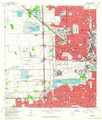
1962 · Hialeah
USGS Topo · 1:24,000

1962 · Opa-locka
USGS Topo · 1:24,000
Featured Places
- Lil Abner Mobile Home Park, FL
- University Lakes Mobile Home Park, FL
- Tamiami, FL
- Miami-Dade County, FL
- United States