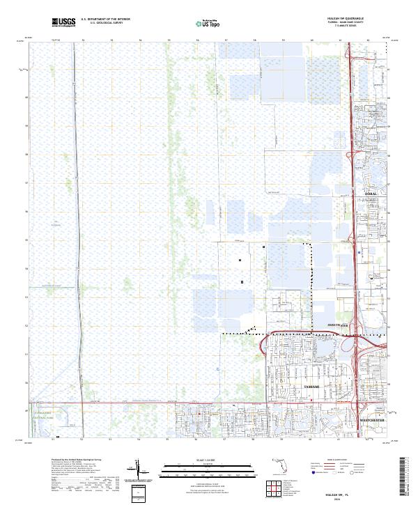
2024 Map of Hialeah SW
USGS Topo · Published 2024About this map
The Everglades define the western reaches of this Miami-Dade County landscape, where the vast wetlands of Everglades National Park meet the expanding suburban edge of South Florida. This boundary is sharply delineated by the Agricultural Canal and north-south service roads, marking the point where the natural preservation area yields to the modern footprints of Doral and Sweetwater. The map documents a complex water management system including the Tamiami Canal Number C-4 and Snapper Creek Canal Number C-2, which are central to the region's development and drainage.
Find a feature on this map
114 named features on this map. Tap any name to fly to it.
Don’t see what you’re looking for? This feature index may not catch every label — zoom into the map to look around manually.
Map Details
Editions of this 2024 Hialeah SW Map
This is the sole edition of this map. No revisions or reprints were ever made.
Other maps of this area

1949 · Opalocka
USGS Topo · 1:24,000

1949 · South Miami NW
USGS Topo · 1:24,000

1950 · Hialeah
USGS Topo · 1:24,000

1950 · South Miami
USGS Topo · 1:24,000

1955 · South Miami NW
USGS Topo · 1:24,000

1956 · South Miami
USGS Topo · 1:24,000

1956 · Miami
USGS Topo · 1:250,000

1958 · Miami
USGS Topo · 1:250,000
1962 · Hialeah
USGS Topo · 1:24,000

1962 · Opa-locka
USGS Topo · 1:24,000
Featured Places
- Lil Abner Mobile Home Park, FL
- University Lakes Mobile Home Park, FL
- Tamiami, FL
- Miami-Dade County, FL
- United States