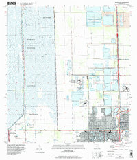
1995 Map of Hialeah SW
USGS Topo · Published 2000About this map
Sweetwater anchors the southeastern corner of this landscape, marking the edge of suburban expansion against the vast water management systems of South Florida. The map illustrates a sharp transition where residential blocks and institutions like the Florida International University (Tamiami Campus) and Belen Jesuit Sch meet the engineered wetlands of the East Coast Buffer. To the west, the Everglades and Francis S Taylor State Wildlife Management Area dominates the terrain, bisected by the iconic Tamiami Trail and the Tamiami Canal. Notable landmarks include the South Florida Reception Center (State Prison) and the Trail Glades Range, reflecting the varied land uses at the city's fringe. Large-scale infrastructure such as Floridas Turnpike and numerous quarries highlight the industrial and transportation arteries feeding the metropolitan area's growth during the mid-1990s.
Find a feature on this map
38 named features on this map. Tap any name to fly to it.
Don’t see what you’re looking for? This feature index may not catch every label — zoom into the map to look around manually.
Map Details
Editions of this 1995 Hialeah SW Map
This is the sole edition of this map. No revisions or reprints were ever made.
Other maps of this area

1949 · Opalocka
USGS Topo · 1:24,000

1949 · South Miami NW
USGS Topo · 1:24,000

1950 · Hialeah
USGS Topo · 1:24,000

1950 · South Miami
USGS Topo · 1:24,000

1955 · South Miami NW
USGS Topo · 1:24,000

1956 · South Miami
USGS Topo · 1:24,000

1956 · Miami
USGS Topo · 1:250,000

1958 · Miami
USGS Topo · 1:250,000
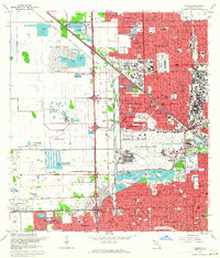
1962 · Hialeah
USGS Topo · 1:24,000

1962 · Opa-locka
USGS Topo · 1:24,000
Featured Places
- Tamiami, FL
- University Lakes Mobile Home Park, FL
- Lil Abner Mobile Home Park, FL
- Miami-Dade County, FL
- United States