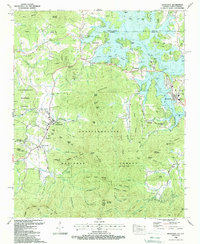
1988 Map of Hiawassee
USGS Topo · Published 1988About this map
Hiawassee and Young Harris serve as the primary hubs in this late-twentieth-century study of the mountain borderlands between Georgia and North Carolina. The landscape is defined by the significant footprint of the Chattahoochee National Forest, with deep coves like Swanson Cove and Kirby Cove providing habitable pockets for small settlements. The map documents a community infrastructure rooted in faith and memory, evidenced by numerous landmarks such as Old Union Ch and the Woods Grove Memorial Cem. To the north, the waters of Chatuge Lake dominate the topography, with multiple boat ramps indicating the area's transition toward recreation. This 1988 update reflects the enduring placement of family-named features like Ramey Mountain and Peabottom Cove Branch, illustrating how local genealogy is etched into the physical geography of Towns Co and Union Co.
Find a feature on this map
135 named features on this map. Tap any name to fly to it.
Don’t see what you’re looking for? This feature index may not catch every label — zoom into the map to look around manually.
Map Details
Editions of this 1988 Hiawassee Map
3 editions found
Other maps of this area

1886 · Dahlonega
USGS Topo · 1:125,000

1892 · Dahlonega
USGS Topo · 1:125,000

1896 · Dahlonega
USGS Topo · 1:125,000

1903 · Dahlonega
USGS Topo · 1:125,000

1935 · Coosa Bald
USGS Topo · 1:24,000

1935 · Peachtree
USGS Topo · 1:24,000

1935 · Osborn
USGS Topo · 1:24,000

1935 · Shooting Creek
USGS Topo · 1:24,000

1935 · Wayah Bald
USGS Topo · 1:48,000

1935 · Tray Mountain
USGS Topo · 1:24,000