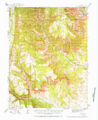
1923 Map of Hiawatha
USGS Topo · Published 1984About this map
Industrial coal operations dominate this early 1920s survey of the Carbon and Emery County borders. The Utah Railway serves as the vital lifeline for the region, connecting the primary settlements of Hiawatha and Mohrland to the broader market. The high-altitude terrain is marked by numerous coal extractions, including the Hiawatha Mine, Mohrland Mine, and the Blackhawk Mine. These operations are carved into the steep flanks of Gentry Mountain and Wattis Mountain, where the canyon landscape dictates the placement of towns and infrastructure.
Find a feature on this map
64 named features on this map. Tap any name to fly to it.
Don’t see what you’re looking for? This feature index may not catch every label — zoom into the map to look around manually.
Map Details
Editions of this 1923 Hiawatha Map
4 editions found
Other maps of this area

1885 · Manti
USGS Topo · 1:250,000

1886 · Price River
USGS Topo · 1:250,000

1895 · Manti
USGS Topo · 1:250,000

1896 · Price River
USGS Topo · 1:250,000

1914 · Castle Gate
USGS Topo · 1:62,500

1916 · Castle Gate
USGS Topo · 1:62,500

1922 · Wasatch
USGS Topo · 1:31,680

1923 · Scofield
USGS Topo · 1:62,500

1923 · Castle Dale
USGS Topo · 1:62,500

1923 · Hiawatha
USGS Topo · 1:62,500