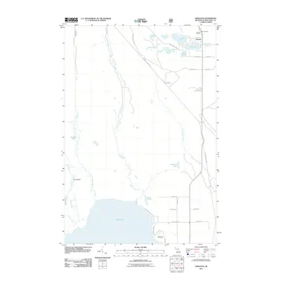
2011 Map of Hiawatha
USGS Topo · Published 2011About this map
Hiawatha and its surrounding wetlands define this landscape in the Upper Peninsula, situated north of the expansive Indian Lake. The map reveals a complex aquatic network, from the winding Smith Creek to the braided sections of The Spreads along the Indian River. Local genealogy is well-supported by the inclusion of Byers Cemetery and Hiawatha Cemetery, providing exact locations for family researchers. The transition from industrial or railway use to modern recreation is evident in the Haywire Grade Orv Trl, which cuts diagonally across the terrain towards Hiawatha Sta. Further south, the Indian Lake Golf Course and a grid of residential roads like Dawson RD and Whitman RD indicate the more developed lakeside community, while northern clusters of water bodies like Bootjack Lake and Island Lake remain tucked into the woods.
Find a feature on this map
41 named features on this map. Tap any name to fly to it.
Don’t see what you’re looking for? This feature index may not catch every label — zoom into the map to look around manually.
Map Details
Editions of this 2011 Hiawatha Map
This is the sole edition of this map. No revisions or reprints were ever made.
Other maps of this area

1931 · Cooks NE
USGS Topo · 1:31,680

1931 · Steuben SE
USGS Topo · 1:31,680

1931 · Steuben SW
USGS Topo · 1:31,680

1931 · Steuben NE
USGS Topo · 1:31,680

1931 · Cooks NW
USGS Topo · 1:31,680

1931 · Steuben NW
USGS Topo · 1:31,680

1931 · Manistique River NW
USGS Topo · 1:31,680

1931 · Manistique River SW
USGS Topo · 1:31,680

1954 · Escanaba
USGS Topo · 1:250,000

1957 · Escanaba
USGS Topo · 1:250,000