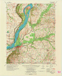
1972 Map of Hickman
USGS Topo · Published 1972About this map
The Mississippi River creates a dynamic border for the western edge of Kentucky, featuring the dramatic Beckwith Bend and the engineered defenses of the Columbus Revet and Hickman Revetment. This riverfront landscape, captured by the U.S. Army Corps of Engineers, reveals a region defined by its complex hydrology and agricultural settlement patterns. The town of Hickman serves as a focal point near the river, while the interior is crisscrossed by waterways like Obion Creek and Bayou de Chien.
Find a feature on this map
59 named features on this map. Tap any name to fly to it.
Don’t see what you’re looking for? This feature index may not catch every label — zoom into the map to look around manually.
Map Details
Editions of this 1972 Hickman Map
This is the sole edition of this map. No revisions or reprints were ever made.
Other maps of this area

1925 · Reelfoot Lake
USGS Topo · 1:62,500

1939 · Wickliffe
USGS Topo · 1:62,500

1939 · Reelfoot Lake
USGS Topo · 1:62,500

1939 · Charleston
USGS Topo · 1:62,500

1939 · Hickman
USGS Topo · 1:62,500

1939 · Bayouville
USGS Topo · 1:62,500

1951 · Cayce
USGS Topo · 1:24,000

1951 · Bondurant
USGS Topo · 1:24,000

1951 · Oakton
USGS Topo · 1:24,000

1951 · Hickman
USGS Topo · 1:24,000