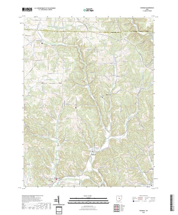
2023 Map of Hickman
USGS Topo · Published 2023About this map
Hickman and the rural townships of eastern Licking County are defined by a network of creeks and runs that cut through the undulating Pleasant Valley landscape. At the southern end of the sheet, the settlement of Wilkins Run sits near its eponymous waterway, while the northern reaches transition into the Knox Co borderlands. The area's social history is anchored by modest community sites like Eden Church and Melita Fellowship Church, alongside several family-named burial grounds such as Souslin Cem and Barnes Cem. The persistence of these small-scale landmarks, from the Smith Chapel in the east to the Flyers Park Airport near Hickman, illustrates a stable agrarian pattern that has survived into the contemporary era. This landscape remains primarily accessible through a grid of township and county roads, including the long stretches of Martinsburg Rd and Rocky Fork Rd.
Find a feature on this map
106 named features on this map. Tap any name to fly to it.
Don’t see what you’re looking for? This feature index may not catch every label — zoom into the map to look around manually.
Map Details
Editions of this 2023 Hickman Map
This is the sole edition of this map. No revisions or reprints were ever made.
Other maps of this area

1909 · Newark
USGS Topo · 1:62,500

1910 · Frazeysburg
USGS Topo · 1:62,500

1912 · Gambier
USGS Topo · 1:62,500

1913 · Brinkhaven
USGS Topo · 1:62,500

1914 · Gambier
USGS Topo · 1:62,500

1915 · Brinkhaven
USGS Topo · 1:62,500

1943 · Gambier
USGS Topo · 1:62,500

1950 · Marion
USGS Topo · 1:250,000

1961 · Hanover
USGS Topo · 1:24,000

1961 · Newark
USGS Topo · 1:24,000