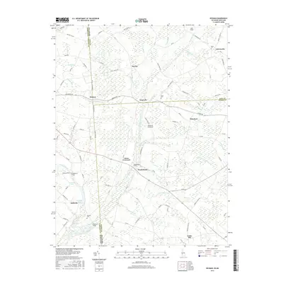
2016 Map of Hickman
USGS Topo · Published 2016About this map
Marshyhope Creek and its many tributaries, such as Cattail Br and Green Br, define the drainage patterns of this rural landscape on the Delmarva Peninsula. The map reveals a high density of small settlements and crossroads typical of this region, including Hickman, Adamsville, and Andrewsville. Land use is primarily agricultural, evidenced by a vast network of drainage features like the Short and Hall Ditch and Hickman Ditch that support the local farming economy.
Find a feature on this map
103 named features on this map. Tap any name to fly to it.
Don’t see what you’re looking for? This feature index may not catch every label — zoom into the map to look around manually.
Map Details
Editions of this 2016 Hickman Map
This is the sole edition of this map. No revisions or reprints were ever made.
Other maps of this area

1905 · Denton
USGS Topo · 1:62,500

1905 · Hurlock
USGS Topo · 1:62,500

1915 · Seaford
USGS Topo · 1:62,500

1918 · Harrington
USGS Topo · 1:62,500

1944 · Denton
USGS Topo · 1:31,680

1944 · Federalsburg
USGS Topo · 1:31,680

1944 · Seaford
USGS Topo · 1:62,500

1944 · Hobbs
USGS Topo · 1:31,680
1944 · Harrington
USGS Topo · 1:62,500

1946 · Salisbury
USGS Topo · 1:250,000