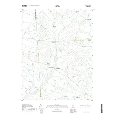
2019 Map of Hickman
USGS Topo · Published 2019About this map
The Delaware Maryland state line bisects this landscape on the Delmarva Peninsula, where the headwaters of Marshyhope Creek and its many tributaries, such as Tomahawk Br and Iron Mine Br, define the low-lying drainage patterns. Small rural communities like Hickman and Adamsville sit at the intersection of long-established country roads, surrounded by an extensive network of agricultural ditches including the Hickman Ditch and Parker and Sampson Ditch. Local history is anchored by several family and community burial sites like Bethel Cem and Todds Cem. The map reveals how the border between Kent, Caroline, and Sussex counties historically shaped the placement of settlements and crossings, notably at Woodenhawk Bridge and Bloomery Bridge, which facilitated movement across the marshy wetlands and small branches that dominate this interior region.
Find a feature on this map
107 named features on this map. Tap any name to fly to it.
Don’t see what you’re looking for? This feature index may not catch every label — zoom into the map to look around manually.
Map Details
Editions of this 2019 Hickman Map
This is the sole edition of this map. No revisions or reprints were ever made.
Other maps of this area

1905 · Denton
USGS Topo · 1:62,500

1905 · Hurlock
USGS Topo · 1:62,500

1915 · Seaford
USGS Topo · 1:62,500

1918 · Harrington
USGS Topo · 1:62,500

1944 · Denton
USGS Topo · 1:31,680

1944 · Federalsburg
USGS Topo · 1:31,680

1944 · Seaford
USGS Topo · 1:62,500

1944 · Hobbs
USGS Topo · 1:31,680
1944 · Harrington
USGS Topo · 1:62,500

1946 · Salisbury
USGS Topo · 1:250,000