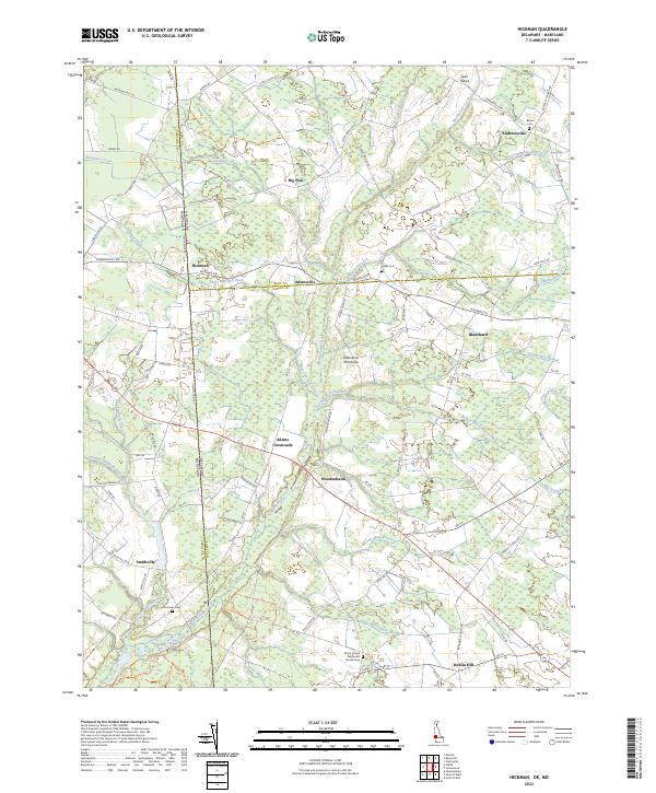
2023 Map of Hickman
USGS Topo · Published 2023About this map
Marshyhope Creek and its many tributaries, including Iron Mine Branch and Jones Mill Branch, define the low-lying agricultural landscape of the Delmarva Peninsula along the Delaware-Maryland border. This modern survey illustrates a network of small, established crossroads communities such as Hickman, Adamsville, and Woodenhawk, which have historically anchored the rural economy of Kent and Sussex Counties. The area's genealogical depth is visible in the distribution of family-named burial sites like Todds Cem and Bloomery Cem, alongside the Trinity United Methodist Church Cem. An extensive system of drainage infrastructure, including the Hickman Ditch and Short and Hall Ditch, reveals the managed nature of this coastal plain terrain, where agricultural fields are carefully reclaimed from the surrounding wetlands.
Find a feature on this map
102 named features on this map. Tap any name to fly to it.
Don’t see what you’re looking for? This feature index may not catch every label — zoom into the map to look around manually.
Map Details
Editions of this 2023 Hickman Map
This is the sole edition of this map. No revisions or reprints were ever made.
Other maps of this area

1905 · Denton
USGS Topo · 1:62,500

1905 · Hurlock
USGS Topo · 1:62,500

1915 · Seaford
USGS Topo · 1:62,500

1918 · Harrington
USGS Topo · 1:62,500

1944 · Denton
USGS Topo · 1:31,680

1944 · Federalsburg
USGS Topo · 1:31,680

1944 · Seaford
USGS Topo · 1:62,500

1944 · Hobbs
USGS Topo · 1:31,680
1944 · Harrington
USGS Topo · 1:62,500

1946 · Salisbury
USGS Topo · 1:250,000