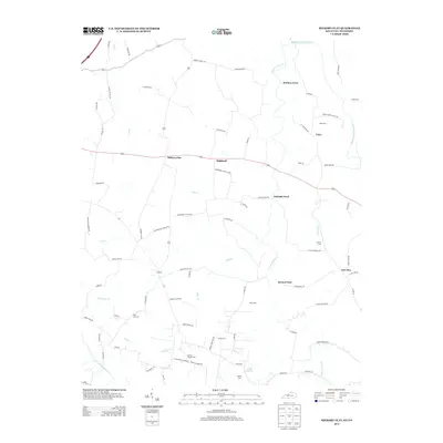
2013 Map of Hickory Flat
USGS Topo · Published 2013About this map
The State Line Cem marks the boundary of this rural landscape, which spans the Kentucky and Tennessee border between Hickory Flat and New Roe. The terrain is defined by a dense network of tributaries including Middle Fork Drakes Cr, Sulphur Fork Cr, and Webb Br, which historical travelers crossed at established points like McElroy Ford, Eubanks Ford, and Bornes Ford. For genealogists and local historians, the map is particularly detailed regarding family-named landmarks and resting places such as Martins Chapel Cem, Allen Cem, and Perdue Cem. The settlement at Rapids and the nearby Boiling Springs indicate a landscape heavily influenced by the hydrology of the Drakes Creek system, where small communities and family farms established themselves along the winding creek branches and secondary roads like Vinegar Hill Rd.
Find a feature on this map
80 named features on this map. Tap any name to fly to it.
Don’t see what you’re looking for? This feature index may not catch every label — zoom into the map to look around manually.
Map Details
Editions of this 2013 Hickory Flat Map
This is the sole edition of this map. No revisions or reprints were ever made.
Other maps of this area

1921 · Bowling Green
USGS Topo · 1:62,500

1923 · Bowling Green
USGS Topo · 1:62,500

1928 · Adolphus
USGS Topo · 1:48,000

1931 · Adolphus
USGS Topo · 1:62,500

1942 · Gallatin
USGS Topo · 1:100,000

1951 · Woodburn
USGS Topo · 1:24,000

1951 · Franklin
USGS Topo · 1:24,000

1954 · Drake
USGS Topo · 1:24,000
1954 · Hickory Flat
USGS Topo · 1:24,000

1954 · Adolphus
USGS Topo · 1:24,000