
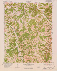
1954 Map of Adolphus
USGS Topo · Published 1956About this map
Adolphus stands at the heart of this mid-century survey, positioned along the Louisville and Nashville railroad line just north of the Kentucky Tennessee state line. The landscape is defined by the winding paths of Trammel Fork and the Middle Fork Drakes Creek, which carve through the terrain between Allen and Sumner counties. This area is notably dense with community institutions, featuring a unique concentration of churches and schools such as Walkers Chapel School and Mt Olive School. The map reveals the local importance of faith and education in the rural South, documented by the presence of Old Buck Creek Ch and New Buck Creek Ch. Smaller settlements like Alonzo, Nubia, and Sugar Grove are linked by a network of unimproved roads and light-duty paths, reflecting the region's agrarian character before modern highway expansion dominated the borderlands.
Find a feature on this map
40 named features on this map. Tap any name to fly to it.
Don’t see what you’re looking for? This feature index may not catch every label — zoom into the map to look around manually.
Map Details
Editions of this 1954 Adolphus Map
2 editions found
Other maps of this area

1921 · Bowling Green
USGS Topo · 1:62,500

1923 · Bowling Green
USGS Topo · 1:62,500

1926 · Scottsville
USGS Topo · 1:62,500

1928 · Adolphus
USGS Topo · 1:48,000

1931 · Lafayette
USGS Topo · 1:62,500

1931 · Adolphus
USGS Topo · 1:62,500

1942 · Gallatin
USGS Topo · 1:100,000

1954 · Drake
USGS Topo · 1:24,000

1954 · Petroleum
USGS Topo · 1:24,000

1954 · Scottsville
USGS Topo · 1:24,000