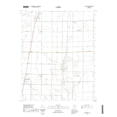
2020 Map of Hickory Ridge
USGS Topo · Published 2020About this map
Hickory Ridge and Fisher anchor this survey of the Arkansas Delta, where the landscape is defined by a dense network of watercourses and agricultural drainage. Running along the western edge, Bayou De View and Old Forked Slough indicate the low-lying, often marshy terrain characteristic of this region. The map reveals a highly structured grid of county roads, such as Green Crossing Rd and Poinsett Co Line Rd, which manage the transit between expansive fields and small settlements like Pittinger.
Find a feature on this map
57 named features on this map. Tap any name to fly to it.
Don’t see what you’re looking for? This feature index may not catch every label — zoom into the map to look around manually.
Map Details
Editions of this 2020 Hickory Ridge Map
This is the sole edition of this map. No revisions or reprints were ever made.
Other maps of this area

1935 · Tuckerman
USGS Topo · 1:62,500

1939 · Vanndale
USGS Topo · 1:62,500

1939 · Weiner
USGS Topo · 1:62,500

1940 · Tilton
USGS Topo · 1:62,500

1953 · Memphis
USGS Topo · 1:250,000

1956 · Memphis
USGS Topo · 1:250,000

1956 · Tilton
USGS Topo · 1:62,500

1958 · Vanndale
USGS Topo · 1:62,500

1959 · Weiner
USGS Topo · 1:62,500

1960 · Weiner
USGS Topo · 1:62,500