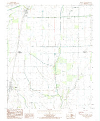
1984 Map of Hickory Ridge
USGS Topo · Published 1985About this map
Hickory Ridge sits at the southern edge of a landscape defined by an intricate network of drainage and water management systems. This mid-1980s provisional map details the rural character of the Poinsett Co Cross Co line, where the natural flow of Bayou De View and Old Forked sloughs meet man-made engineering like Ditch No 15 and Mc Coy Ditch. The transition from natural wetlands to agricultural land is evident in features such as Brushey Lake and the various named creeks that drain the flat lowlands.
Find a feature on this map
15 named features on this map. Tap any name to fly to it.
Don’t see what you’re looking for? This feature index may not catch every label — zoom into the map to look around manually.
Map Details
Editions of this 1984 Hickory Ridge Map
This is the sole edition of this map. No revisions or reprints were ever made.
Other maps of this area

1935 · Tuckerman
USGS Topo · 1:62,500

1939 · Vanndale
USGS Topo · 1:62,500

1939 · Weiner
USGS Topo · 1:62,500

1940 · Tilton
USGS Topo · 1:62,500

1953 · Memphis
USGS Topo · 1:250,000

1956 · Memphis
USGS Topo · 1:250,000

1956 · Tilton
USGS Topo · 1:62,500

1958 · Vanndale
USGS Topo · 1:62,500

1959 · Weiner
USGS Topo · 1:62,500

1960 · Weiner
USGS Topo · 1:62,500