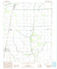
1992 Map of Hickory Ridge
USGS Topo · Published 1993About this map
Hickory Ridge and Fisher anchor this survey of the Arkansas Delta as it appeared in the early 1980s. The landscape is defined by its complex water management, where natural features like Bayou De View and the Old Forked Slough coexist with an extensive network of man-made drainage, including Ditch No 15 and the Mc Coy Ditch. This grid-like pattern of ditches and canals reflects a highly engineered agricultural environment designed to move water off the fertile plains and into tributaries such as Overcup Creek and Twomile Creek.
Find a feature on this map
14 named features on this map. Tap any name to fly to it.
Don’t see what you’re looking for? This feature index may not catch every label — zoom into the map to look around manually.
Map Details
Editions of this 1992 Hickory Ridge Map
This is the sole edition of this map. No revisions or reprints were ever made.
Other maps of this area

1935 · Tuckerman
USGS Topo · 1:62,500

1939 · Vanndale
USGS Topo · 1:62,500

1939 · Weiner
USGS Topo · 1:62,500

1940 · Tilton
USGS Topo · 1:62,500

1953 · Memphis
USGS Topo · 1:250,000

1956 · Memphis
USGS Topo · 1:250,000

1956 · Tilton
USGS Topo · 1:62,500

1958 · Vanndale
USGS Topo · 1:62,500

1959 · Weiner
USGS Topo · 1:62,500

1960 · Weiner
USGS Topo · 1:62,500