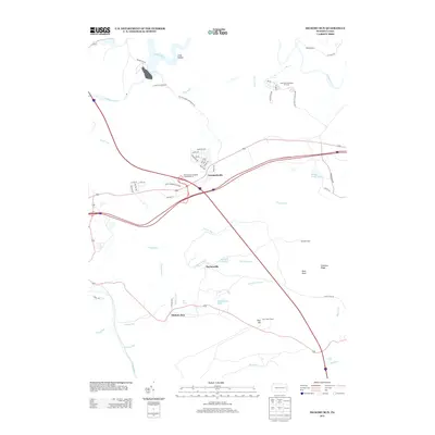
2013 Map of Hickory Run
USGS Topo · Published 2013About this map
Leonardsville and Saylorsville anchor a landscape defined by the convergence of major travel routes and natural features. The Pennsylvania Turnpike cuts across the terrain at Pennsylvania Turnpike Interchange 35, marking a modern industrial contrast to the surrounding highlands. Recreational and youth-focused institutions are well-established here, including Camp Acahela along the Tobyhanna Cr and the Laurel Mountain Resort.
Find a feature on this map
56 named features on this map. Tap any name to fly to it.
Don’t see what you’re looking for? This feature index may not catch every label — zoom into the map to look around manually.
Map Details
Editions of this 2013 Hickory Run Map
This is the sole edition of this map. No revisions or reprints were ever made.
Other maps of this area

1889 · Hazleton
USGS Topo · 1:62,500

1891 · Wilkesbarre
USGS Topo · 1:62,500

1891 · Hazleton
USGS Topo · 1:62,500

1893 · Hazleton
USGS Topo · 1:62,500

1894 · Wilkesbarre
USGS Topo · 1:62,500

1922 · Mauch Chunk
USGS Topo · 1:62,500

1922 · Stoddartsville
USGS Topo · 1:62,500

1924 · Stoddartsville
USGS Topo · 1:62,500

1924 · Mauch Chunk
USGS Topo · 1:62,500

1943 · Scranton
USGS Topo · 1:125,000
Featured Places
- Kidder Township, PA
- Hickory Run, Kidder Township
- Pocono Mountain Lake Estates, Kidder Township
- Buck Township, PA
- Lehigh Township, PA