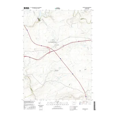
2016 Map of Hickory Run
USGS Topo · Published 2016About this map
The Lehigh Gorge carves through the western edge of this Carbon County landscape, where the Lehigh River meets the engineering of the Francis E Walter Dam. This terrain is defined by its deep hollows and high ridges, including Chestnut Ridge and Pine Hill, which frame a network of mountain streams like Sand Spring Run and Irishtown Run. Settlement is concentrated in established residential clusters such as Pocono Mountain Lake Estates, Leonardsville, and Saylorsville, situated near the intersection of major transit corridors.
Find a feature on this map
45 named features on this map. Tap any name to fly to it.
Don’t see what you’re looking for? This feature index may not catch every label — zoom into the map to look around manually.
Map Details
Editions of this 2016 Hickory Run Map
This is the sole edition of this map. No revisions or reprints were ever made.
Other maps of this area

1889 · Hazleton
USGS Topo · 1:62,500

1891 · Wilkesbarre
USGS Topo · 1:62,500

1891 · Hazleton
USGS Topo · 1:62,500

1893 · Hazleton
USGS Topo · 1:62,500

1894 · Wilkesbarre
USGS Topo · 1:62,500

1922 · Mauch Chunk
USGS Topo · 1:62,500

1922 · Stoddartsville
USGS Topo · 1:62,500

1924 · Stoddartsville
USGS Topo · 1:62,500

1924 · Mauch Chunk
USGS Topo · 1:62,500

1943 · Scranton
USGS Topo · 1:125,000
Featured Places
- Kidder Township, PA
- Hickory Run, Kidder Township
- Pocono Mountain Lake Estates, Kidder Township
- Buck Township, PA
- Lehigh Township, PA