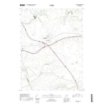
2019 Map of Hickory Run
USGS Topo · Published 2019About this map
Lehigh Gorge and the winding course of the Lehigh River define the western edge of this landscape at the intersection of Carbon, Luzerne, and Monroe counties. Modern residential pockets like Pocono Mountain Lake Estates and Leonardsville sit north of the expansive parklands, while smaller settlements such as Saylorsville and East Side provide glimpses into the local community structure. The map highlights a significant network of water features including Sand Spring Lake, Hickory Run Lake, and the scenic drop of Hawk Falls.
Find a feature on this map
47 named features on this map. Tap any name to fly to it.
Don’t see what you’re looking for? This feature index may not catch every label — zoom into the map to look around manually.
Map Details
Editions of this 2019 Hickory Run Map
This is the sole edition of this map. No revisions or reprints were ever made.
Other maps of this area

1889 · Hazleton
USGS Topo · 1:62,500

1891 · Wilkesbarre
USGS Topo · 1:62,500

1891 · Hazleton
USGS Topo · 1:62,500

1893 · Hazleton
USGS Topo · 1:62,500

1894 · Wilkesbarre
USGS Topo · 1:62,500

1922 · Mauch Chunk
USGS Topo · 1:62,500

1922 · Stoddartsville
USGS Topo · 1:62,500

1924 · Stoddartsville
USGS Topo · 1:62,500

1924 · Mauch Chunk
USGS Topo · 1:62,500

1943 · Scranton
USGS Topo · 1:125,000
Featured Places
- Kidder Township, PA
- Hickory Run, Kidder Township
- Pocono Mountain Lake Estates, Kidder Township
- Buck Township, PA
- Lehigh Township, PA