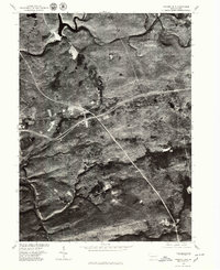
1976 Map of Hickory Run
USGS Topo · Published 1979About this map
Lehigh River bends sharply through this Carbon County landscape, defining the western edge of a region characterized by deep valleys and high plateaus. Captured in the mid-1970s via aerial orthophotography, the map reveals the intersection of modern transportation with small, established settlements. The cluster at Leonardsville sits near a major highway junction, illustrating the evolution of local transit from historic mountain passes to high-speed corridors. Further south, Saylorville remains tucked away near the eponymous Hickory Run, showing the persistent footprint of these smaller communities amidst the expanding forest cover. In the northeast, the confluence of Tobyhanna Creek and the river highlights the natural drainage patterns that have shaped the industrial and recreational history of the area, while the settlement of East Side occupies a strategic bend in the river's path.
Find a feature on this map
6 named features on this map. Tap any name to fly to it.
Don’t see what you’re looking for? This feature index may not catch every label — zoom into the map to look around manually.
Map Details
Editions of this 1976 Hickory Run Map
This is the sole edition of this map. No revisions or reprints were ever made.
Other maps of this area

1889 · Hazleton
USGS Topo · 1:62,500

1891 · Wilkesbarre
USGS Topo · 1:62,500

1891 · Hazleton
USGS Topo · 1:62,500

1893 · Hazleton
USGS Topo · 1:62,500

1894 · Wilkesbarre
USGS Topo · 1:62,500

1922 · Mauch Chunk
USGS Topo · 1:62,500

1922 · Stoddartsville
USGS Topo · 1:62,500

1924 · Stoddartsville
USGS Topo · 1:62,500

1924 · Mauch Chunk
USGS Topo · 1:62,500

1943 · Scranton
USGS Topo · 1:125,000
Featured Places
- Kidder Township, PA
- Buck Township, PA
- Penn Forest Township, PA
- Tobyhanna Township, PA
- Saylorsville, Kidder Township