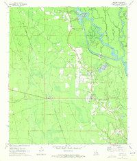
1971 Map of Hickory
USGS Topo · Published 1972About this map
Hickory and Florenville serve as central points in this St. Tammany Parish landscape, situated within a complex network of waterways and timberland. The eastern edge is dominated by the winding course of the West Pearl River and Pearl River, which creates a labyrinth of sloughs and bayous including Maple Slough and Indian Bayou. This era of the early 1970s shows a landscape still defined by its natural topography, though industrial influence is visible through a prominent Pipeline and the Gulf Mobile and Ohio railroad corridor.
Find a feature on this map
50 named features on this map. Tap any name to fly to it.
Don’t see what you’re looking for? This feature index may not catch every label — zoom into the map to look around manually.
Map Details
Editions of this 1971 Hickory Map
4 editions found
Other maps of this area

1914 · Nicholson
USGS Topo · 1:62,500

1921 · Nicholson
USGS Topo · 1:62,500

1935 · Slidell
USGS Topo · 1:62,500

1939 · Slidell
USGS Topo · 1:62,500

1941 · Honey Island
USGS Topo · 1:31,680

1942 · Talisheek
USGS Topo · 1:31,680

1942 · Walkiah Bluff
USGS Topo · 1:31,680

1950 · Haaswood
USGS Topo · 1:31,680

1950 · Slidell
USGS Topo · 1:62,500

1953 · Mobile
USGS Topo · 1:250,000