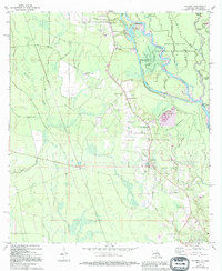
1971 Map of Hickory
USGS Topo · Published 1994About this map
The lowlands of St. Tammany Parish are defined by the winding course of the Pearl River and the complex hydrology of the Bogue Chitto National Wildlife Refuge. In the early 1970s, this landscape was a mix of dense wetlands and emerging settlements like Hickory and Florenville. The mapping details several family-named landmarks and rural gathering places, including Evans Creek Ch and Charter Oak Missionary Ch, which served the scattered communities near the Mississippi border.
Find a feature on this map
53 named features on this map. Tap any name to fly to it.
Don’t see what you’re looking for? This feature index may not catch every label — zoom into the map to look around manually.
Map Details
Editions of this 1971 Hickory Map
4 editions found
Other maps of this area

1914 · Nicholson
USGS Topo · 1:62,500

1921 · Nicholson
USGS Topo · 1:62,500

1935 · Slidell
USGS Topo · 1:62,500

1939 · Slidell
USGS Topo · 1:62,500

1941 · Honey Island
USGS Topo · 1:31,680

1942 · Talisheek
USGS Topo · 1:31,680

1942 · Walkiah Bluff
USGS Topo · 1:31,680

1950 · Haaswood
USGS Topo · 1:31,680

1950 · Slidell
USGS Topo · 1:62,500

1953 · Mobile
USGS Topo · 1:250,000