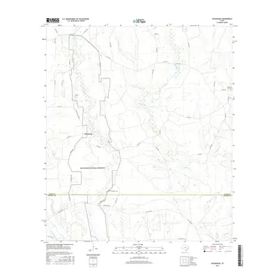
2016 Map of Hicksbaugh
USGS Topo · Published 2016About this map
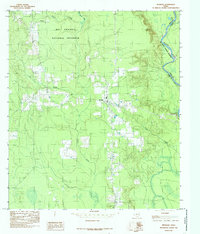
Hicksbaugh sits at the heart of this East Texas landscape, where the dense hydrology of the Piney Woods defines the local geography. The area is dominated by the sprawling boundaries of the Big Thicket National Preserve, which encompasses significant portions of the drainage basins for Turkey Cr and Theuvenins Cr. This survey illustrates a quiet, rural network of forest roads and small family burial grounds that anchor the local genealogy of Tyler and Hardin counties. Scattered throughout the woods are sites such as Gardner Cem, Hester Cem, and the Baker and Nolan Cem near the eastern boundary. The map captures the transition between managed timberlands and protected wilderness, with long thoroughfares like Gore Store Rd and Bumstead Cemetary Rd cutting through the creek bottoms and wetlands of Thouching Cr and Beech Cr.
Find a feature on this map
46 named features on this map. Tap any name to fly to it.
Don’t see what you’re looking for? This feature index may not catch every label — zoom into the map to look around manually.
Map Details
Editions of this 2016 Hicksbaugh Map
This is the sole edition of this map. No revisions or reprints were ever made.
Other maps of this area

1954 · Beaumont
USGS Topo · 1:250,000
1955 · Silsbee
USGS Topo · 1:62,500
1955 · Kountze
USGS Topo · 1:62,500

1957 · Beaumont
USGS Topo · 1:250,000
1958 · Warren
USGS Topo · 1:62,500
1958 · Spurger
USGS Topo · 1:62,500
1984 · Beaumont
USGS Topo · 1:250,000
1984 · Hillister
USGS Topo · 1:24,000
1984 · Warren
USGS Topo · 1:24,000
1984 · Spurger
USGS Topo · 1:24,000