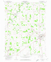
1958 Map of Hicksville
USGS Topo · Published 1974About this map
The St Joseph River meanders across the state line between Indiana and Ohio, defining the rural character of this borderland during the mid-20th century. The settlement of Hicksville serves as a local hub, featuring a concentration of urban infrastructure including the County Fairgrounds, a Sewage Disposal plant, and the vital tracks of the Baltimore and Ohio railroad. This industrial and transportation corridor contrasts with the surrounding agricultural townships like Newville and Milford, where smaller communities such as Orangeville and Coburn Corners are anchored by local landmarks like Coburn Corners Ch.
Find a feature on this map
46 named features on this map. Tap any name to fly to it.
Don’t see what you’re looking for? This feature index may not catch every label — zoom into the map to look around manually.
Map Details
Editions of this 1958 Hicksville Map
4 editions found
Other maps of this area

1914 · Bryan
USGS Topo · 1:62,500

1914 · Paulding
USGS Topo · 1:62,500

1943 · Bryan
USGS Topo · 1:62,500

1944 · Paulding
USGS Topo · 1:62,500

1953 · Fort Wayne
USGS Topo · 1:250,000

1956 · Fort Wayne
USGS Topo · 1:250,000

1958 · Hicksville
USGS Topo · 1:24,000

1958 · Grabill
USGS Topo · 1:24,000

1958 · Butler West
USGS Topo · 1:24,000

1958 · Woodburn North
USGS Topo · 1:24,000