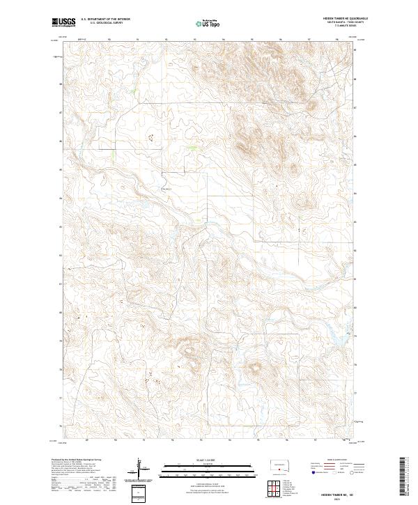
2021 Map of Hidden Timber NE
USGS Topo · Published 2021About this map
Keya Paha River defines the central character of this prairie landscape in Todd County, winding through the northern portion of the Rosebud Reservation area. This 2021 topographic survey illustrates a drainage system dominated by the river and its southern tributaries, including Eagle Creek and Eagle Cr. The terrain is marked by the complex dissection of the plains, where small draws and coulees like Crazy Hole Cr have carved into the plateau. While the map is devoid of named settlements or major infrastructure, it preserves the precise township and range boundaries such as t37n r25w, which are essential for locating specific land parcels and ancestral allotments in this section of South Dakota.
Find a feature on this map
10 named features on this map. Tap any name to fly to it.
Don’t see what you’re looking for? This feature index may not catch every label — zoom into the map to look around manually.
Map Details
Editions of this 2021 Hidden Timber NE Map
This is the sole edition of this map. No revisions or reprints were ever made.
Other maps of this area

1955 · Martin
USGS Topo · 1:250,000

1958 · Martin
USGS Topo · 1:250,000

1982 · Hidden Timber
USGS Topo · 1:24,000

1982 · Okreek
USGS Topo · 1:25,000

1982 · Witten SW
USGS Topo · 1:25,000

1982 · Hidden Timber SE
USGS Topo · 1:24,000

1982 · Okreek SE
USGS Topo · 1:24,000
1982 · Keyapaha NW
USGS Topo · 1:24,000
1982 · Hidden Timber NE
USGS Topo · 1:24,000
1982 · Keyapaha
USGS Topo · 1:24,000