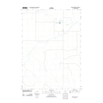
2012 Map of Hidden Timber
USGS Topo · Published 2012About this map
Hidden Timber serves as the focal point for this rural South Dakota landscape, situated within the Antelope Segment of Todd County. The settlement patterns in this region of the Great Plains are dictated by the presence of water, with the Keya Paha River flowing through the northeastern corner. This watercourse is joined by several significant tributaries, including Antelope Cr and the winding Rock Cr, which carves through much of the western and central territory. The primary infrastructure is defined by Hidden Timber Rd, which provides the main north-south arterial link for the few structures and homesteads scattered across this open country. This survey illustrates the delicate balance between habitation and the prairie environment in the early 21st century.
Find a feature on this map
5 named features on this map. Tap any name to fly to it.
Don’t see what you’re looking for? This feature index may not catch every label — zoom into the map to look around manually.
Map Details
Editions of this 2012 Hidden Timber Map
This is the sole edition of this map. No revisions or reprints were ever made.
Other maps of this area

1955 · Martin
USGS Topo · 1:250,000

1958 · Martin
USGS Topo · 1:250,000

1982 · Olsonville
USGS Topo · 1:24,000

1982 · Olsonville SE
USGS Topo · 1:24,000

1982 · Hidden Timber
USGS Topo · 1:24,000

1982 · Okreek
USGS Topo · 1:25,000

1982 · Hidden Timber SE
USGS Topo · 1:24,000

1982 · Okreek SE
USGS Topo · 1:24,000
1982 · Mission SE
USGS Topo · 1:24,000
1982 · Hidden Timber NE
USGS Topo · 1:24,000