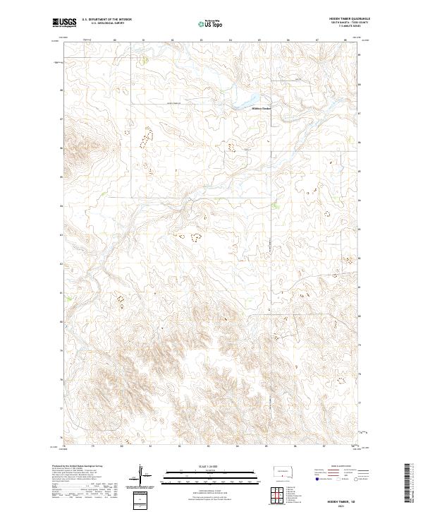
2021 Map of Hidden Timber
USGS Topo · Published 2021About this map
Hidden Timber serves as the focal point for this section of Todd County, located along the rolling breaks above the Antelope Creek drainage. The landscape is defined by the winding course of the Keya Paha River in the northeast, which is fed by several tributaries including Rock Cr and Antelope Cr. The map reveals a sparsely populated ranching or agricultural environment where infrastructure is limited to essential connectors like Sage Rd, Hidden Timber Rd, and 289th St. The survey data provided by the U.S. Geological Survey emphasizes the natural topography of the Great Plains, illustrating how the drainage patterns of the river system have shaped the local settlement patterns and the placement of the modest community of Hidden Timber.
Find a feature on this map
14 named features on this map. Tap any name to fly to it.
Don’t see what you’re looking for? This feature index may not catch every label — zoom into the map to look around manually.
Map Details
Editions of this 2021 Hidden Timber Map
This is the sole edition of this map. No revisions or reprints were ever made.
Other maps of this area

1955 · Martin
USGS Topo · 1:250,000

1958 · Martin
USGS Topo · 1:250,000

1982 · Olsonville
USGS Topo · 1:24,000

1982 · Olsonville SE
USGS Topo · 1:24,000

1982 · Hidden Timber
USGS Topo · 1:24,000

1982 · Okreek
USGS Topo · 1:25,000

1982 · Hidden Timber SE
USGS Topo · 1:24,000

1982 · Okreek SE
USGS Topo · 1:24,000
1982 · Mission SE
USGS Topo · 1:24,000
1982 · Hidden Timber NE
USGS Topo · 1:24,000