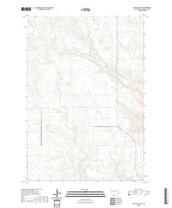
2021 Map of High Elk Hill SE
USGS Topo · Published 2021About this map
The watershed of Rudy Cr defines the landscape of this Ziebach County quadrangle, where the creek meanders across the northern and eastern sections of the township grid. This 2021 survey reveals a vast, open terrain characterized by intricate drainage patterns and subtle relief, with Dupree Cr cutting through the western reaches. The area is marked by a strict adherence to the Public Land Survey System, as evidenced by the clearly defined sections of t10n r23e and its neighbors. Human infrastructure is minimal, represented primarily by the simple network of Co Rd routes that follow the section lines. This map provides a clear view of the rural South Dakota landscape, highlighting how natural watercourses like Rudy Creek continue to dictate the placement of roads and property boundaries in the modern era.
Find a feature on this map
9 named features on this map. Tap any name to fly to it.
Don’t see what you’re looking for? This feature index may not catch every label — zoom into the map to look around manually.
Map Details
Editions of this 2021 High Elk Hill SE Map
This is the sole edition of this map. No revisions or reprints were ever made.
Other maps of this area

1954 · Pierre
USGS Topo · 1:250,000

1956 · Cherry Creek NW
USGS Topo · 1:24,000

1956 · Carlin Flat
USGS Topo · 1:24,000

1956 · Alleman Station
USGS Topo · 1:24,000

1958 · Pierre
USGS Topo · 1:250,000

1981 · Herbert Creek
USGS Topo · 1:24,000

1981 · Herbert Creek SW
USGS Topo · 1:24,000

1981 · High Elk Hill NW
USGS Topo · 1:24,000

1981 · High Elk Hill SE
USGS Topo · 1:24,000
1981 · High Elk Hill
USGS Topo · 1:24,000