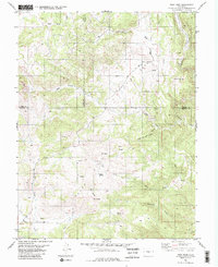
1983 Map of High Park
USGS Topo · Published 1983About this map
The High Park area of central Colorado is defined by a high-elevation landscape of ridges and drainages where Park, Teller, and Fremont counties converge. Surveyed in the mid-1970s and edited in the early 1980s, the terrain is dominated by prominent summits including Big Baldy, Oblong Baldy, and the Booger Red Hill. The drainage patterns are intricate, with seasonal and permanent flows such as Left Hand Creek and Fourmile Creek carving through the Bare Hills.
Find a feature on this map
23 named features on this map. Tap any name to fly to it.
Don’t see what you’re looking for? This feature index may not catch every label — zoom into the map to look around manually.
Map Details
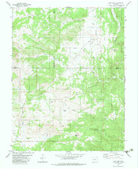
Editions of this 1983 High Park Map
2 editions found
Other maps of this area

1894 · Pikes Peak
USGS Topo · 1:125,000

1901 · Pikes Peak
USGS Topo · 1:125,000

1901 · Pikes Peak
USGS Topo · 1:62,500

1942 · Cover Mtn.
USGS Topo · 1:62,500

1948 · Cover Mtn.
USGS Topo · 1:62,500

1951 · Cripple Creek South
USGS Topo · 1:24,000

1951 · Cripple Creek North
USGS Topo · 1:24,000

1954 · Cooper Mountain
USGS Topo · 1:24,000

1954 · Pueblo
USGS Topo · 1:250,000

1957 · Pueblo
USGS Topo · 1:250,000