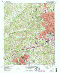
1969 Map of High Point West
USGS Topo · Published 1987About this map
The industrial corridor of the North Carolina Piedmont is well-defined here as the corporate limits of High Point and Thomasville begin to converge during the late 1960s. This survey illustrates the dense urban grid of High Point’s western side, featuring the City Hall County Bldg and numerous educational institutions like Oak Hill Sch and Tomlinson Sch. The landscape between the cities is marked by the winding courses of Rich Fork and Abbotts Creek, which carve through the terrain near Westchester Academy and the Willow Creek Country Club. Significant transportation infrastructure, including the Southern Ry and the Carolina and Northwestern Ry, underscores the region's historic role as a furniture and manufacturing hub. Smaller settlements and neighborhoods like Oakview, Erwin Heights, and Jimmys appear alongside vital local landmarks such as Mendenhall Airport and City Memorial Hospital.
Find a feature on this map
75 named features on this map. Tap any name to fly to it.
Don’t see what you’re looking for? This feature index may not catch every label — zoom into the map to look around manually.
Map Details
Editions of this 1969 High Point West Map
2 editions found
Other maps of this area

1949 · Eller
USGS Topo · 1:24,000

1949 · High Point West
USGS Topo · 1:24,000

1950 · High Point East
USGS Topo · 1:24,000

1950 · Lexington East
USGS Topo · 1:24,000

1950 · Winston-Salem East
USGS Topo · 1:24,000

1951 · Winston-Salem East
USGS Topo · 1:24,000

1951 · Lexington East
USGS Topo · 1:24,000

1951 · High Point East
USGS Topo · 1:24,000

1951 · Guilford
USGS Topo · 1:24,000

1951 · Fair Grove
USGS Topo · 1:24,000