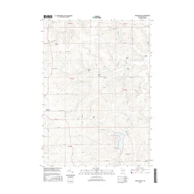
2016 Map of Highland East
USGS Topo · Published 2016About this map
Highland and its surrounding rural townships in Iowa County are defined by a network of dendritic stream valleys and prominent upland ridges. Waterways such as Pompey Pillar Cr and Smoky Hollow Cr carve through the landscape, leading toward the significant recreation area at Black Hawk Lake. This 2016 survey illustrates the persistent agricultural and cemetery-dotted character of the region, where family and community heritage is preserved at sites like Saint Malachy Cem and Blabaum Cem. The map reveals how the terrain influenced local development, with settlements like Sunny Ridge and Spring Valley positioned along the higher ground above the many hollows. Distinctive landmarks such as Pompey Pillar and Maiden Rock serve as geological anchor points in a territory where traditional land divisions of the Public Land Survey System remain clearly visible.
Find a feature on this map
71 named features on this map. Tap any name to fly to it.
Don’t see what you’re looking for? This feature index may not catch every label — zoom into the map to look around manually.
Map Details
Editions of this 2016 Highland East Map
This is the sole edition of this map. No revisions or reprints were ever made.
Other maps of this area

1902 · Mineral Point
USGS Topo · 1:125,000

1905 · Richland Center
USGS Topo · 1:125,000

1952 · Montfort
USGS Topo · 1:24,000

1952 · Dodgeville
USGS Topo · 1:24,000

1952 · Linden
USGS Topo · 1:24,000

1958 · La Crosse
USGS Topo · 1:250,000

1959 · Dubuque
USGS Topo · 1:250,000

1960 · Muscoda
USGS Topo · 1:62,500

1960 · Spring Green
USGS Topo · 1:62,500

1961 · Dubuque
USGS Topo · 1:250,000