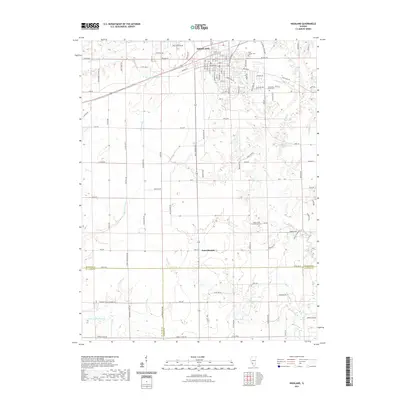
2021 Map of Highland
USGS Topo · Published 2021About this map
Highland serves as the primary urban center in this 2021 study, situated at the meeting point of several regional drainage systems and road networks. The landscape is defined by the headwaters and branches of E Fork Silver Cr and Little Silver Cr, which weave through the agricultural and residential outskirts. To the south, the settlement of Saint Morgan sits near the crossing of the Madison County and St. Clair County lines, illustrating the persistence of smaller communities within the rural Illinois prairie. Genealogy and local history researchers will find several significant burial sites, including the large Saint Joseph Cem on the north side of town and the more secluded Sugar Creek Presbyterian Cem and Rietmann Family Cem located to the southeast. The area is also dotted with numerous small water bodies such as Lake Wanda, Sportsman Lake, and Heavenly Hills Lake, reflecting the local hydrography and recreational land use.
Find a feature on this map
109 named features on this map. Tap any name to fly to it.
Don’t see what you’re looking for? This feature index may not catch every label — zoom into the map to look around manually.
Map Details
Editions of this 2021 Highland Map
This is the sole edition of this map. No revisions or reprints were ever made.
Other maps of this area

1906 · Breese
USGS Topo · 1:62,500

1907 · Breese
USGS Topo · 1:62,500

1907 · Belleville
USGS Topo · 1:62,500

1927 · Edwardsville
USGS Topo · 1:62,500

1932 · Edwardsville
USGS Topo · 1:62,500

1935 · Lebanon
USGS Topo · 1:24,000

1937 · New Douglas
USGS Topo · 1:48,000

1944 · New Douglas
USGS Topo · 1:62,500

1949 · Lebanon
USGS Topo · 1:24,000

1949 · St. Jacob
USGS Topo · 1:24,000