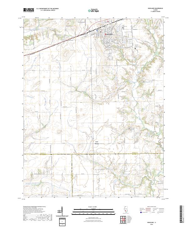
2024 Map of Highland
USGS Topo · Published 2024About this map
Highland serves as the primary hub of this landscape, situated at the intersection of a detailed street grid and modern thoroughfares like Veterans Honor Pkwy. The town is characterized by institutional landmarks such as Saint Joseph Cem and a dense network of numbered streets, while the surrounding rural landscape to the south transition into the smaller community of Saint Morgan. This area reflects a long history of local settlement, evidenced by family-scale sites like the Rietmann Family Cem.
Find a feature on this map
121 named features on this map. Tap any name to fly to it.
Don’t see what you’re looking for? This feature index may not catch every label — zoom into the map to look around manually.
Map Details
Editions of this 2024 Highland Map
This is the sole edition of this map. No revisions or reprints were ever made.
Other maps of this area

1906 · Breese
USGS Topo · 1:62,500

1907 · Breese
USGS Topo · 1:62,500

1907 · Belleville
USGS Topo · 1:62,500

1927 · Edwardsville
USGS Topo · 1:62,500

1932 · Edwardsville
USGS Topo · 1:62,500

1935 · Lebanon
USGS Topo · 1:24,000

1937 · New Douglas
USGS Topo · 1:48,000

1944 · New Douglas
USGS Topo · 1:62,500

1949 · Lebanon
USGS Topo · 1:24,000

1949 · St. Jacob
USGS Topo · 1:24,000