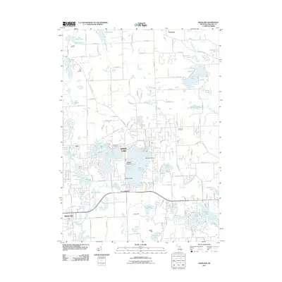
2011 Map of Highland
USGS Topo · Published 2011About this map
White Lake serves as the central focal point of this Oakland County landscape, characterized by its intricate shoreline and prominent landforms such as Dawsons Island and Hubbels Island. The surrounding township is a patchwork of water and residential development, with established communities like Seven Harbors and East Highland anchoring the local geography. To the west, the village of Highland and the settlement of Clyde represent historic clusters of activity near the headwaters of Pettibone Creek.
Find a feature on this map
144 named features on this map. Tap any name to fly to it.
Don’t see what you’re looking for? This feature index may not catch every label — zoom into the map to look around manually.
Map Details
Editions of this 2011 Highland Map
This is the sole edition of this map. No revisions or reprints were ever made.
Other maps of this area

1907 · Pontiac
USGS Topo · 1:62,500

1909 · Milford
USGS Topo · 1:62,500

1920 · Holly
USGS Topo · 1:62,500

1922 · Holly
USGS Topo · 1:62,500

1936 · Wixom
USGS Topo · 1:31,680

1936 · Highland
USGS Topo · 1:31,680

1936 · Clarkston
USGS Topo · 1:31,680

1936 · Walled Lake
USGS Topo · 1:31,680

1942 · Highland
USGS Topo · 1:24,000

1943 · Holly
USGS Topo · 1:62,500
Featured Places
- White Lake Charter Township, MI
- Highland Charter Township, MI
- Springfield Charter Township, MI
- Seven Harbors, Highland Charter Township
- Clyde, Highland Charter Township