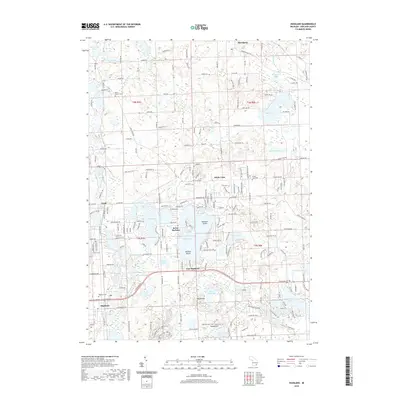
2019 Map of Highland
USGS Topo · Published 2019About this map
The glacial landscape of Oakland County is defined here by a dense network of kettle lakes and wetlands, centered on the unincorporated communities of Highland and White Lake. This 2019 survey documents a region characterized by significant water bodies such as Duck Lake, Big Lake, and the sprawling White Lake, which contains Dawsons Island and Hubbels Island. The drainage patterns are established by Pettibone Creek and the Shiawassee River, while several prominent elevations like Haven Hill and Teeple Hill rise above the surrounding lake basins. For genealogists and local historians, the map preserves the locations of established burial grounds including Rose Center Cem, White Lake Cem, and Highland Cem. Residential clusters like Seven Harbors and East Highland reflect the area's development around its abundant waterfronts, connected by a network of historic routes like Milford Rd and Andersonville Rd.
Find a feature on this map
210 named features on this map. Tap any name to fly to it.
Don’t see what you’re looking for? This feature index may not catch every label — zoom into the map to look around manually.
Map Details
Editions of this 2019 Highland Map
This is the sole edition of this map. No revisions or reprints were ever made.
Other maps of this area

1907 · Pontiac
USGS Topo · 1:62,500

1909 · Milford
USGS Topo · 1:62,500

1920 · Holly
USGS Topo · 1:62,500

1922 · Holly
USGS Topo · 1:62,500

1936 · Wixom
USGS Topo · 1:31,680

1936 · Highland
USGS Topo · 1:31,680

1936 · Clarkston
USGS Topo · 1:31,680

1936 · Walled Lake
USGS Topo · 1:31,680

1942 · Highland
USGS Topo · 1:24,000

1943 · Holly
USGS Topo · 1:62,500
Featured Places
- White Lake Charter Township, MI
- Highland Charter Township, MI
- Springfield Charter Township, MI
- Seven Harbors, Highland Charter Township
- Clyde, Highland Charter Township