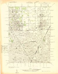
1936 Map of Highland Park
USGS Topo · Published 1936About this map
Highland Park and Hamtramck are shown as bustling urban enclaves surrounded by the northward expansion of Detroit during the mid-1930s. This survey, compiled from aerial photographs, illustrates the dense grid of residential streets punctuated by essential infrastructure like the Highland Park Reservoir and Detroit City Airport. The transition from industrial city life to the suburban and agricultural fringes is evident as one moves north toward Ferndale and Centerline, where drainage features like Bear Creek and Beaver Creek still define much of the open land.
Find a feature on this map
170 named features on this map. Tap any name to fly to it.
Don’t see what you’re looking for? This feature index may not catch every label — zoom into the map to look around manually.
Map Details
Editions of this 1936 Highland Park Map
This is the sole edition of this map. No revisions or reprints were ever made.
Other maps of this area

1905 · Detroit
USGS Topo · 1:62,500

1905 · Grosse Pointe
USGS Topo · 1:62,500

1908 · Rochester
USGS Topo · 1:62,500

1912 · Mt Clemens
USGS Topo · 1:62,500

1918 · Detroit
USGS Topo · 1:62,500

1918 · Grosse Pointe
USGS Topo · 1:62,500

1924 · Detroit
USGS Topo · 1:62,500

1929 · Mt Clemens
USGS Topo · 1:62,500

1934 · Detroit
USGS Topo · 1:62,500

1936 · Warren
USGS Topo · 1:31,680