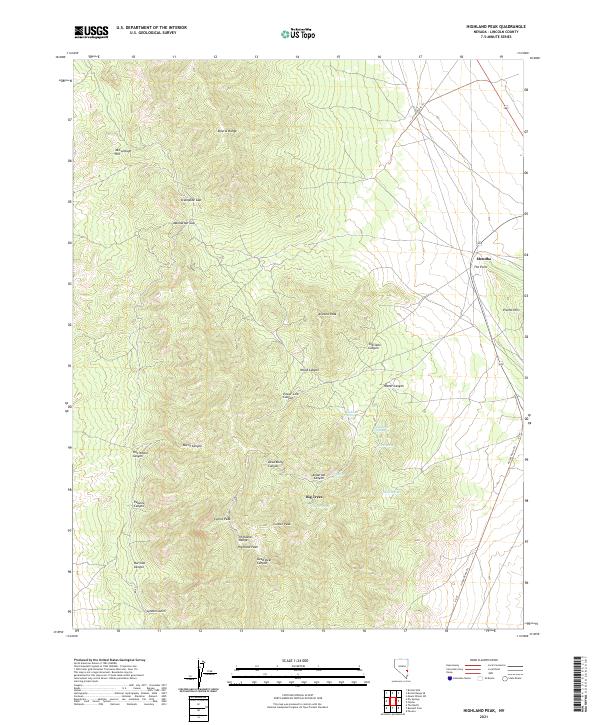
2021 Map of Highland Peak
USGS Topo · Published 2021About this map
Highland Peak dominates this high-altitude landscape in the southern reaches of the Bristol Range and Highland Range. The map reveals a topography defined by steep vertical relief and a network of named drainages including Sheridan Canyon, Peaslee Canyon, and Dead Bull Canyon. Human presence is concentrated near the eastern edge at Mendha and Big Trees, while the rugged interior is accessible primarily via the Access Route Trl and various mountain passes like Stampede Gap and Manhattan Gap. Water sources are sparse but critical markers of local history and land use, represented by several high-elevation seeps such as Highland Spring, Deadman Spring, and Floral Spring. This survey illustrates the intricate relationship between the region's complex geology and the infrastructure required to navigate its high-desert peaks and canyons.
Find a feature on this map
38 named features on this map. Tap any name to fly to it.
Don’t see what you’re looking for? This feature index may not catch every label — zoom into the map to look around manually.
Map Details
Editions of this 2021 Highland Peak Map
This is the sole edition of this map. No revisions or reprints were ever made.
Other maps of this area

1885 · Pioche
USGS Topo · 1:250,000

1886 · Pioche
USGS Topo · 1:250,000

1915 · Bristol Range
USGS Topo · 1:62,500

1916 · Highland
USGS Topo · 1:62,500

1917 · Bristol Range
USGS Topo · 1:62,500

1918 · Highland
USGS Topo · 1:62,500

1921 · NW 1/4 Panaca
USGS Topo · 1:48,000

1953 · Highland Peak
USGS Topo · 1:24,000

1953 · Bristol Range SE
USGS Topo · 1:24,000

1953 · Pioche
USGS Topo · 1:24,000