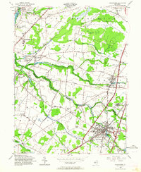
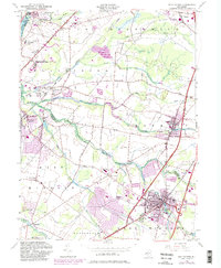
1954 Map of Hightstown
USGS Topo · Published 1964About this map
The Pennsylvania Railroad anchors this mid-century landscape, cutting a diagonal path through central New Jersey and connecting key regional hubs. The borough of Hightstown serves as a dense residential and commercial focal point, featuring the Peddie Prep Sch and the Peddie Country Club alongside the waters of Peddie Lake. Moving northwest, the map documents the academic and research footprint of the era, including the Princeton University Laboratory and the Princeton University Medical Research Center near the Millstone River.
Find a feature on this map
66 named features on this map. Tap any name to fly to it.
Don’t see what you’re looking for? This feature index may not catch every label — zoom into the map to look around manually.
Map Details
Editions of this 1954 Hightstown Map
5 editions found
Other maps of this area

1888 · Bordentown
USGS Topo · 1:62,500

1888 · New Brunswick
USGS Topo · 1:62,500

1888 · Princeton
USGS Topo · 1:62,500

1888 · Cassville
USGS Topo · 1:62,500

1893 · Bordentown
USGS Topo · 1:62,500

1893 · New Brunswick
USGS Topo · 1:62,500

1894 · Princeton
USGS Topo · 1:62,500

1894 · Cassville
USGS Topo · 1:62,500

1900 · Cassville
USGS Topo · 1:62,500

1901 · New Brunswick
USGS Topo · 1:62,500
Featured Places
- Franklin Township, NJ
- South Brunswick, NJ
- East Windsor Township, NJ
- West Windsor, NJ
- Plainsboro Township, NJ